Contact Seller
London Fine Antiques
Tel02071833511or07889 725 975Please quote Antiques Atlas.

 Antique Surrey Map, English, County Cartography
 Antique Dual Sided Carnarvonshire Map, Atlas
 Antique Wiltshire County Map, Dutch, Cartography
 Vintage Map, Lincoln, Nottingham, English, Print
 Robert Morden Map of Cumberland (Cumbria), c.1695
 Antique Town Plan, Portsmouth Dockyard, English
 Antique Salisbury to Campden Coaching Map, English
 Antique Map of England & Wales, French, Framed
 Vintage Voyage Map, French, After Henri Chatelain
 Vintage Map, British North America, Canadian
 Antique Map of Surrey, English, Framed, County
 Antique Italian Region Map, Framed Cartography
Non UK callers :
+44 2071833511
or +44 7889 725 975
or +44 7889 725 975
Antique London Street Map, Aldersgate, English



Our Stock # 26150
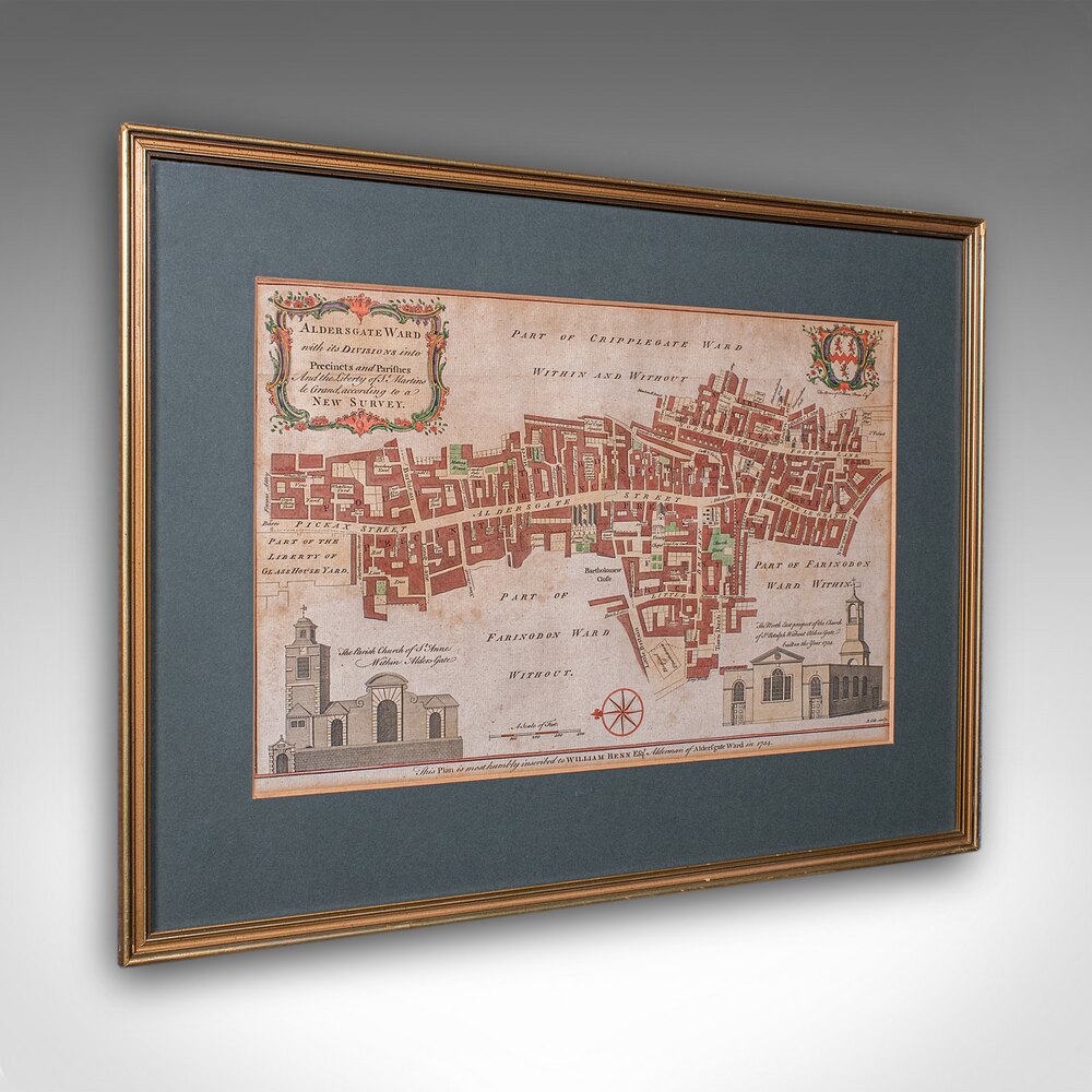
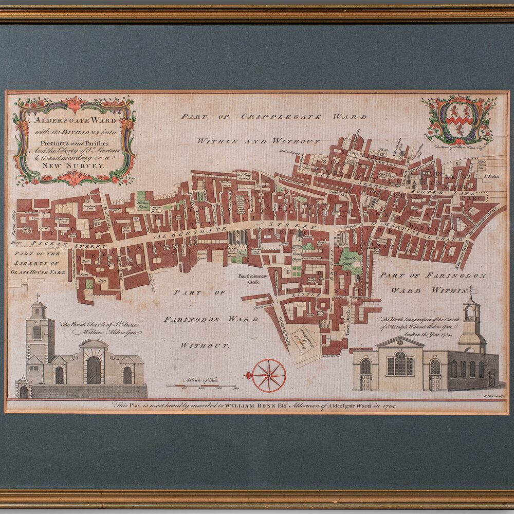
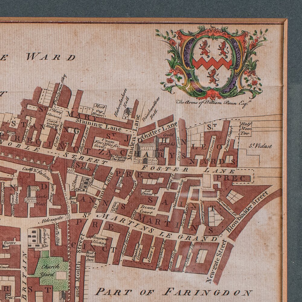
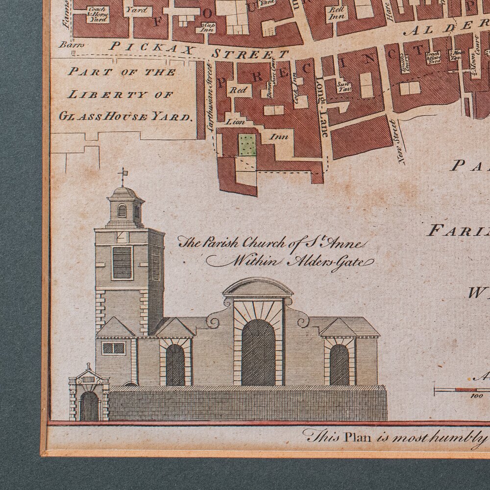
This is an antique London street map. An English, framed and hand-coloured map showing the ward of Aldersgate, dating to the Georgian period and later, circa 1754.
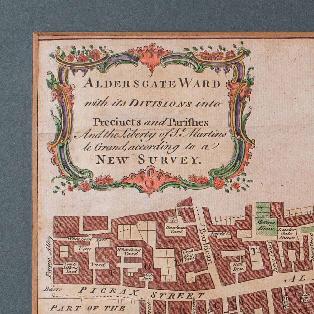
Full title: Aldersgate Ward with its Divisions into Precincts and Parishes and the Liberty of St Martins le Grand, according to a New Survey.
Delightful London interest, as it stood when surveyed in the mid 18th century
Presented behind clear bright glass and mounted within a tasteful deep green card border
Displays a desirable aged patina, with a gilt-finished later frame
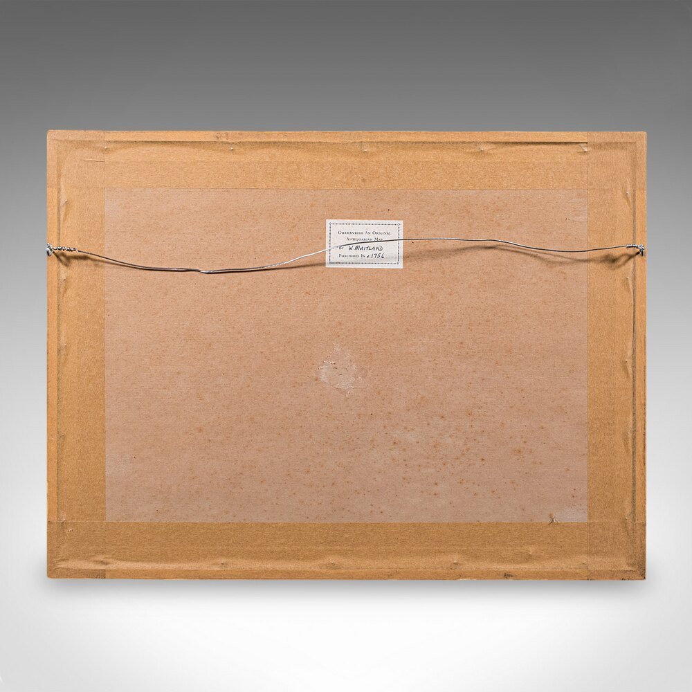
Dressed to the rear with mounting wire for ease of hanging
Title given within a decorative cartouche to the upper part of the map
Hand coloured for added visual interest and legibility
Heraldic interest with the family coat of arms for the cartographer William Benn Esquire
Encompassing Aldersgate Street, Barbican and Trinity Chapel
Fine architectural excerpts for the Churches of St Anne and St Botolph respectively
Named and dated by William Benn in the year 1754
This is a charming 18th century London street map, with appealing lithography detail and tasteful presentation. Delivered ready to display.
Dimensions:
Max Width: 50cm (19.75'')
Max Depth: 1cm (.5'')
Max Height: 37.5cm (14.75'')
Map Width: 37.5cm (14.75'')
Map Height: 24cm (9.5'')
We offer a 100% satisfaction guarantee with all of our antiques.
We ship worldwide with professional packing and attractive rates – please send us your post / zip code and country for a quote.
Free delivery to most of the U.K. – Please send us your post code for confirmation.
Deliveries taking on average ten working days to arrive at your door from receipt of payment.
Please contact us if you require any further information - we are here to help.
Our Ref: 26150 Free delivery to most of the. U. K. & fast worldwide shipping
SellerLondon Fine Antiques
View all stock from
London Fine Antiques

 Unit 4B
Courtlands Trading Estate
Taunton
Somerset
TA2 6NS
Tel : 02071833511
or : 07889 725 975
Non UK callers : +44 2071833511 or +44 7889 725 975
Get directions to London Fine Antiques
This is an antique London street map. An English, framed and hand-coloured map showing the ward of Aldersgate, dating to the Georgian period and later, circa 1754.
Full title: Aldersgate Ward with its Divisions into Precincts and Parishes and the Liberty of St Martins le Grand, according to a New Survey.
Delightful London interest, as it stood when surveyed in the mid 18th century
Presented behind clear bright glass and mounted within a tasteful deep green card border
Displays a desirable aged patina, with a gilt-finished later frame
Dressed to the rear with mounting wire for ease of hanging
Title given within a decorative cartouche to the upper part of the map
Hand coloured for added visual interest and legibility
Heraldic interest with the family coat of arms for the cartographer William Benn Esquire
Encompassing Aldersgate Street, Barbican and Trinity Chapel
Fine architectural excerpts for the Churches of St Anne and St Botolph respectively
Named and dated by William Benn in the year 1754
This is a charming 18th century London street map, with appealing lithography detail and tasteful presentation. Delivered ready to display.
Dimensions:
Max Width: 50cm (19.75'')
Max Depth: 1cm (.5'')
Max Height: 37.5cm (14.75'')
Map Width: 37.5cm (14.75'')
Map Height: 24cm (9.5'')
We offer a 100% satisfaction guarantee with all of our antiques.
We ship worldwide with professional packing and attractive rates – please send us your post / zip code and country for a quote.
Free delivery to most of the U.K. – Please send us your post code for confirmation.
Deliveries taking on average ten working days to arrive at your door from receipt of payment.
Please contact us if you require any further information - we are here to help.
Our Ref: 26150 Free delivery to most of the. U. K. & fast worldwide shipping
Price
Arrange a final price and delivery details directly with the dealer
Click here to message the seller The price has been listed in British Pounds.
Conversion rates as of 23/JUL/2026. Euro & Dollar prices will vary and should only be used as a guide.
Always confirm final price with dealer.
Category Antique Ephemera
Date c.1750
George II Antiques Material Paper
Origin English
Item code as272a9326 / 26150
Status For Sale
£585.00 
$779.22
€685.21

$779.22

€685.21

Looking to Buy?
Payment with PayPal is availableArrange a final price and delivery details directly with the dealer
Click here to message the seller

Conversion rates as of 23/JUL/2026. Euro & Dollar prices will vary and should only be used as a guide.
Always confirm final price with dealer.
View all stock from
London Fine Antiques

 Unit 4B
Courtlands Trading Estate
Taunton
Somerset
TA2 6NS
Tel : 02071833511
or : 07889 725 975
Non UK callers : +44 2071833511 or +44 7889 725 975
Get directions to London Fine Antiques
You may also be interested in
 Antique Surrey Map, English, County Cartography
 Antique Dual Sided Carnarvonshire Map, Atlas
 Antique Wiltshire County Map, Dutch, Cartography
 Vintage Map, Lincoln, Nottingham, English, Print
 Robert Morden Map of Cumberland (Cumbria), c.1695
 Antique Town Plan, Portsmouth Dockyard, English
 Antique Salisbury to Campden Coaching Map, English
 Antique Map of England & Wales, French, Framed
 Vintage Voyage Map, French, After Henri Chatelain
 Vintage Map, British North America, Canadian
 Antique Map of Surrey, English, Framed, County
 Antique Italian Region Map, Framed Cartography