Antiques for Sale | Antique Furniture | Antique Fairs | Antiques Listings | Antiques Email Alerts | Websites for Antique Dealers | Contact
Colophon Books
Tel : 01538370045. Mobile : 07976 922873
Email : pageandturner@outlook.com
Web : https://www.abebooks.co.uk/colophon-books-uk-leek/53391264/sf
Web : www.antiques-atlas.com/colophonbooks/
Private dealer
By appointment only
Near Leek
Staffordshire
By appointment only. Please ring or email with all enquiries.
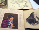
Herman Moll. Atlas Minor. 1736. 58 Hand-cold Maps


Photos


Description
Herman Moll. (Geographer)Atlas Minor Or a new and Curious Set of Maps in Which Are Shewn All the Empires, Kingdoms, Countries, States in the Known Parts of the Earth, etc.(58 of the 62 maps only)
Pub by Thomas & John Bowles. 3rd state. 1736.
Description: 3rd Edition of 1736. Comprises 58 maps of the allotted 62, lacks the maps for England (With Roads) + Spain with Roads and A General Map of Turkey and Barbadoes (sic) With Roads. It has the copper engraved index/title with the father and son as the printers, UNLIKE later 18th century copies with only the son, followed by a double page Map of the Whole World North and Southern Hemispheres, all with contemporary colouring they were issued in two-states, plain an coloured, all double page with: 24 maps of Europe inc Greece and numbered 3-29, followed by Asia + The Caspian Sea + Great Tartary (dated 1732 from the 2nd edition) + Turkey in Asia + Arabia + Persia and the Caspian Sea + Empire of the Mogul + Empire of China + The East Indies + Principal Islands of the East Indies + Africa + West & East Part of Barbary [dated 1732] + Negroland and Guinea + St Helena & The Bay of Agoa (2 on one sheet) The South Part of Africa and Madagascar + America + New Map of ye North Parts of America Claimed by France (Louisiana, Mississippi, Canada, New France, with adjoining territories of England & Spain) + Newfoundland, St Laurence Bay (fishing banks) & Part of New Scotland + Bay of Fundy and New Scotland + New England, New York, New Jersey and Pennsylvania + Virginia and Maryland + Carolina + Plan of Port Royal in Carolina + Bermuda and Providence Island + Florida (called by the French Louisiana) + The West Indies, Mexico and New Spain + Jamaica + St Christophers or St Kitts + The Island of Antego (sic) + The Scots Settlement of New Caledonia as in 1699 + Terra Firma (Peru, Amazone-Land, Brasil and La Plata) + Chili, Patagonia and the South of Brasil (sic). 7 maps are fold-out and the rest double page, France is loose and damaged with an ink stain and some old brown spots mainly in the borders, map 60 "New Caledonia" has some browning to top edge, there are 3 with archival clear repairs to the backs where the fold lines have started to split, firming the maps and the light repairs cannot be seen from the fronts, some small edge splits started on some, the double page copper engraved index of maps has the unusual geographical and surveyors instrument design border and uncommon, there is some loss at edges to the plate line on both sides, otherwise as said, a nice addition not often found. Maps start at Number 3 with the Hemispherical map and the North Pole numbered 1+2. The colouring (rare as issued plain) is bright on all maps and maps are very good or better in the main. Original calf worn with the top board detached and leather very worn. Selling as 58 of 62 maps with 31 of the more remote and mostly uncharted parts of the globe (California is shown as an Island) and a total of 17 the Americas maps (of 18) and 24 of 27 of the European theatre of the world. Originally 1st printed in 1729 and then again in 1732, this has 2 maps dated 1732, but map 13 has the 3rd state map, so dating to 1736, later editions in the 1780's were printed but with Carrington Bowles imprints and not the father Thomas. And from different addresses than this copy
DateMid 18th Century :
1736
Codeas1189a021
PriceSold
StatusSold
SellerColophon Books
Telephone01538370045Non UK callers :+44 1538370045 Emailpageandturner@outlook.com
Contact
Send Colophon Books a message about this item here