Antiques for Sale | Antique Furniture | Antique Fairs | Antiques Listings | Antiques Email Alerts | Websites for Antique Dealers | Contact

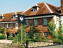
The Swan at Tetsworth Antiques Centre
Tel : 01844 281777
Email : antiques@theswan.co.uk
Web : www.theswan.co.uk
Web : www.antiques-atlas.com/theswan/
High Street, Tetsworth
Oxfordshire
England, UK OX9 7AB
Open: daily 10am to 6pm
Ogilby strip map of coaching route between Bristol


Description
Coloured strip map of the initial portion of the coaching route from London to Bristol, ca 1675, taken from John Ogilby’s “Britannia”, the first national road atlas of any country in Western Europe and first published in 1675. Framed and glazed.DateRestoration :
1675
MakerOgilby
Dimensions33.5 x 77cm
ConditionVery Good
Codeas314a188 / AA18/0812
Price £380.00  €444.26
  $483.63
  The price has been listed in British Pounds.
Conversion rates as of 21/AUG/2023.
Euro & Dollar prices will vary and should only be used as a guide.
Always confirm final price with dealer.StatusFor Sale SellerThe Swan at Tetsworth Antiques Centre Telephone01844 281777Non UK callers :+44 1844 281777 Emailantiques@theswan.co.uk
 €444.26
  $483.63
  The price has been listed in British Pounds.
Conversion rates as of 21/AUG/2023.
Euro & Dollar prices will vary and should only be used as a guide.
Always confirm final price with dealer.StatusFor Sale SellerThe Swan at Tetsworth Antiques Centre Telephone01844 281777Non UK callers :+44 1844 281777 Emailantiques@theswan.co.uk
Contact
Send The Swan at Tetsworth Antiques Centre a message about this item here
